Overview
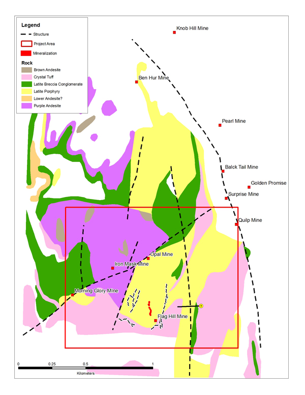
 The Flag Hill and Flag Hill South propert are located in the Republic Gold Mine district where more than 4 million ounces of gold (average grade 20g/t) and 15.8 million ounces of silver (average grade 110 g/t) were recovered. This area is located approximtely 10 kilometres from the Kettle River Mill.
FLAG HILL
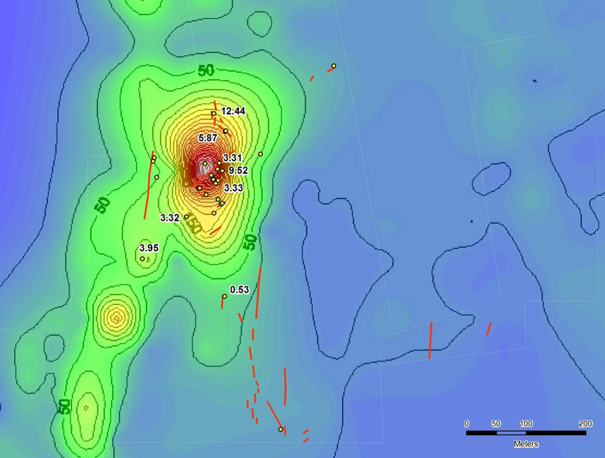
Gold occurs at Flag Hill within epithermal veins similar to what was mined in the Republic district. The reported gold grade of the Flag Hill vein is 7.2 g/t. Other veins identified on the property assay between 2.2-12.5 g/t gold. These veins have not been reported to have been drill tested. The only drill hole recorded on the property is 300 metres east of the Flag Hill vein and it is reported to have intersected 41 g/t gold and 277 g/t silver over approximately 1 metre.
FLAG HILL SOUTH
The recently acquired Flag Hill South Property is located just south of Adamera’s Flag Hill Gold Property.
Adamera has identified, mapped and sampled five individual epithermal quartz veins on the Flag Hill South property to date. One vein, the C3 vein, exposed in a shallow adit, measures 3 metres in width. On surface it has been traced for more than 200m. A rock sample collected from the adit assayed 9.1 g/t gold over 1.2 metres. There is no evidence suggesting this vein or any other veins on the property have ever been tested by drilling. The veins exhibit textures and geochemistry suggesting they represent high-level emplacement of a low sulphidation epithermal gold system.
A drill program will target potential high-grade gold in “boiling zone” portions of the system which is believed to be preserved at shallow depths.
The first target to be tested is the C-3 vein in the central part of the property. This vein system has been traced on the surface and projected under overburden for more than 400 metres. Two sections on the vein will be targeted initially. The first section, a zone with up to 9.1 g/t gold in chip samples and the second section, a zone with up to 6.6 g/t gold in chip samples. Both locations are marked by distinct inflections or kinks in strike whereby the vein changes azimuth by at least 20 degrees. The first drill holes will test these points of inflection.